World-Leading Drone Geophysics Surveys

High-Resolution Drone Magnetic Surveys for Mineral & Geotechnical Exploration

Shift Geophysics mission is to deliver high‑quality geophysical data that supports informed decision‑making, driving discovery and confidence in resource and geotechnical development.

We achieve this through:

  • A commitment to quality at every stage of a project
  • A deep understanding of client needs and desired outcomes
  • The application of innovation to deliver effective, practical solutions

High-Resolution Drone Magnetometer Data

Shift Geophysics acquires the highest quality geophysical data possible by utilising the worlds most advanced drone magnetometer bird;

  • 3pT/rt Hz sensitivity Rubidium magnetometer.
  • Towed configuration removing the magnetometer from electromagnetic drone noise.
  • Aeronautically engineered for stability at low and fast speeds
  • 1,000Hz sample rate
  • Integrated GPS, laser altimeter and inertial measurement unit (IMU).
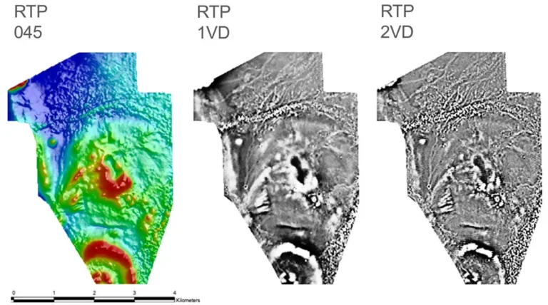
Drone TMI magnetic survey results displayed as three RTP images: RTP 045, RTP 1VD and RTP 2VD, with a 4 km scale bar.

Precision Magnetic Data Processing

An integrated inertial measurement unit enables Shift Geophysics data processors—bringing over 80 years of combined experience to accurately compensate the data, reducing residual noise to a fraction of what most competitors deliver.

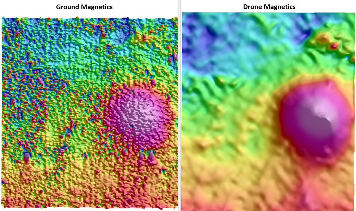
The value of drone magnetic surveys over manned airborne systems lies in their exceptionally high resolution and ability to map geological structure at a level not achievable by other methods—particularly in complex terrain or at low altitude.

Ground magnetics vs drone magnetics TMI comparison showing magnetic anomaly response across two airborne and ground-based geophysical survey methods.

Purpose-Built Drone Survey Platforms

Shift Geophysics selects and modifies drones specifically to meet the demands of geophysical surveying, with:

  • Dual‑band RTK GPS
  • Laser altimeter for precise terrain clearance
  • Advanced 200 Hz autopilot processing to maintain stability in gusty conditions

Coupled with Starlink connectivity, Shift Geophysics drones can accurately drape terrain across large, remote, and logistically challenging areas—anywhere in the world.